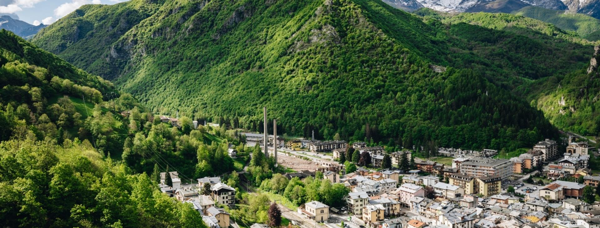
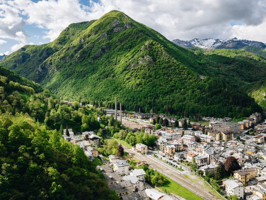
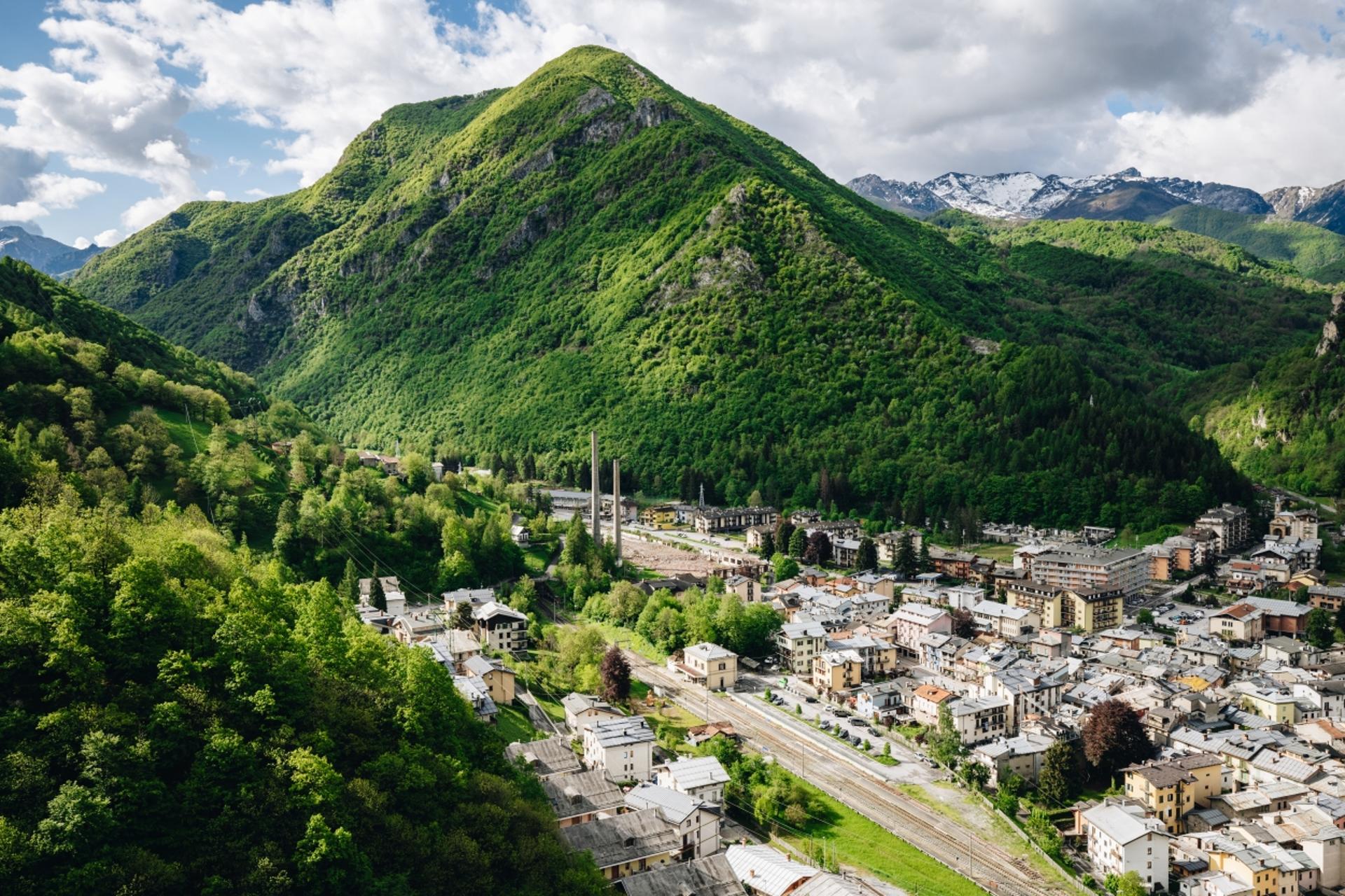
ENTRACQUE, VALLE GESSO, VALLE VERMENAGNA, VERNANTE
TRINITÀ DI ENTRACQUE - PALANFRÈ
approx. 27,5 km (17 mi)
An itinerary that runs entirely along trails of the Grande Traversata delle Alpi (GTA), which are excellently prepared despite crossing rugged, isolated areas. This trek crosses a wide variety of landscapes, ranging from scenic ridges to dense beech forests, through secluded valleys and past small alpine lakes. The return runs through the extensive Sabbione valley, which then joins up with the Bousset valley. It’s an excursion for true connoisseurs of the Alps that’s to be taken on in the right season, i.e. early autumn when the vegetation is less lush and the temperatures are not too high.
If you’d like, you can do the stages in reverse order, starting from Palanfrè and staying overnight in Trinità di Entracque at the Sorriso inn.
It should be noted that the mountains are an environment subject to constant change and conditions that can vary depending on the weather, the season, climate change, and human influence. The authors and ATL del Cuneese (the Cuneo board of tourism) decline any responsibility for any injury or other harmful consequences deriving from use of the information provided. Each itinerary is to be followed at your own risk.
The Stages
the route
No result found
No result found


Discover
more
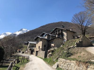
Start: Trinità di Entracque
Stage 1: Trinità di Entracque–Palanfrè by way of Colle della Garbella
Ascent: approx. 1,120 m (3,675 ft)
Descent: approx. 840 m (2,755 ft)
Total length: approx. 11.5 km (7 mi)
Elevation at start: 1,084 m (3,556 ft)
Highest elevation: 2,203 m (7,228 ft)
Difficulty level: E (intermediate)
From Trinità di Entracque, head back down and turn right after a few dozen meters into the Prer valley. The road, initially paved, rises steeply at the foot of a fantastic arc of limestone walls and then becomes dirt near a fork in road (signpost).
Take the right branch that climbs into mixed forest alternating with stretches of beech forest. After about a kilometer (at an elevation of about 1,300 m, or 4,265 ft), leave this road onto a lovely mule track to the left (white-and-red markings), a false flat through the narrow and deep Grande valley (not to be confused with the nearby valley of the same name in Palanfrè). Two hundred meters ahead (elevation: 1,322 m), ignore an old abandoned trail on the left and continue straight along a rocky stretch alongside the stream. There’s a steel cable here that will be helpful if the rocks are wet.
At the end of this section, you will enter a lovely beech forest on the foothills of Caire di Porcera as you climb through steep hairpin bends. Climb over a few easy rock formations with metal steps, leaving the beech trees behind as you enter a depression. The trail continues very intuitively past the final alders, through which there are nice views of Entracque, and out onto an open, grassy slope.
Zig-zag up the slope to Colle Porcera (1,797 m), overlooking the steep Bousset valley. Continue left along the trail that traverses the slope and then zigzags steeply up to a shoulder. From here, the route changes completely and traverses across the grassy recesses of Mount Pianard, where you can enjoy excellent views of the peaks on the opposite side. Despite the steepness of the slope that plunges towards the Bousset valley, the trail is wide and perfectly prepared.
After rounding a ridge, the trail continues steadily uphill, cutting across other depressions. Above an elevation of about 2,100 meters (6,900 ft), the slope becomes gradually less steep and soon you will reach Colle della Garbella (2,173 m), located at the watershed between the Bousset and Grande valleys, from where you can enjoy excellent views out towards the Bisalta massif, the peaks of the Vermenagna valley, and the arc of mountains that goes from the Vernasca summit to Mount Aiera.
Leave Mount Pianard and Rocca d’Orel behind you, and continue south along this beautiful, broad ridge. Through panoramic ups and downs, you will reach the highest point of this excursion (2,203 m). Much further on, the trail turns left and begins to descend decisively into the Garbella valley at the foot of the rocky outcrops of the mountain of the same name.
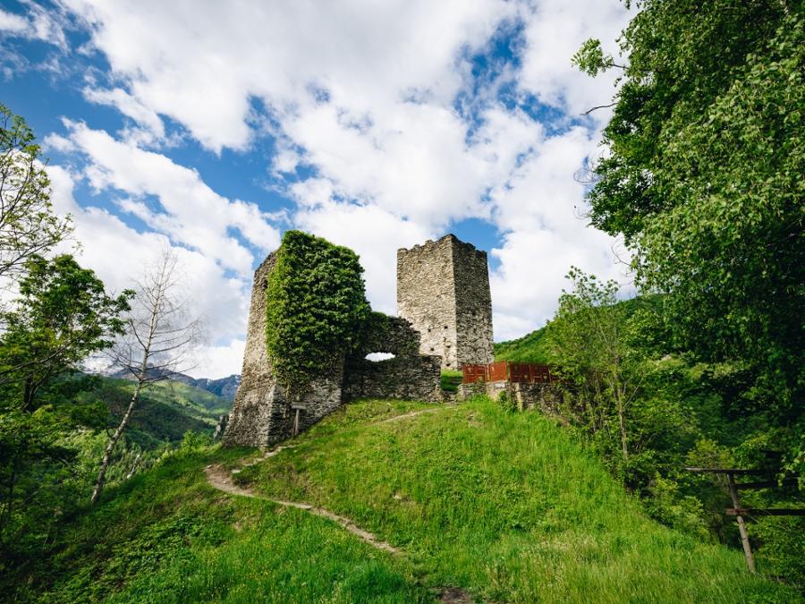
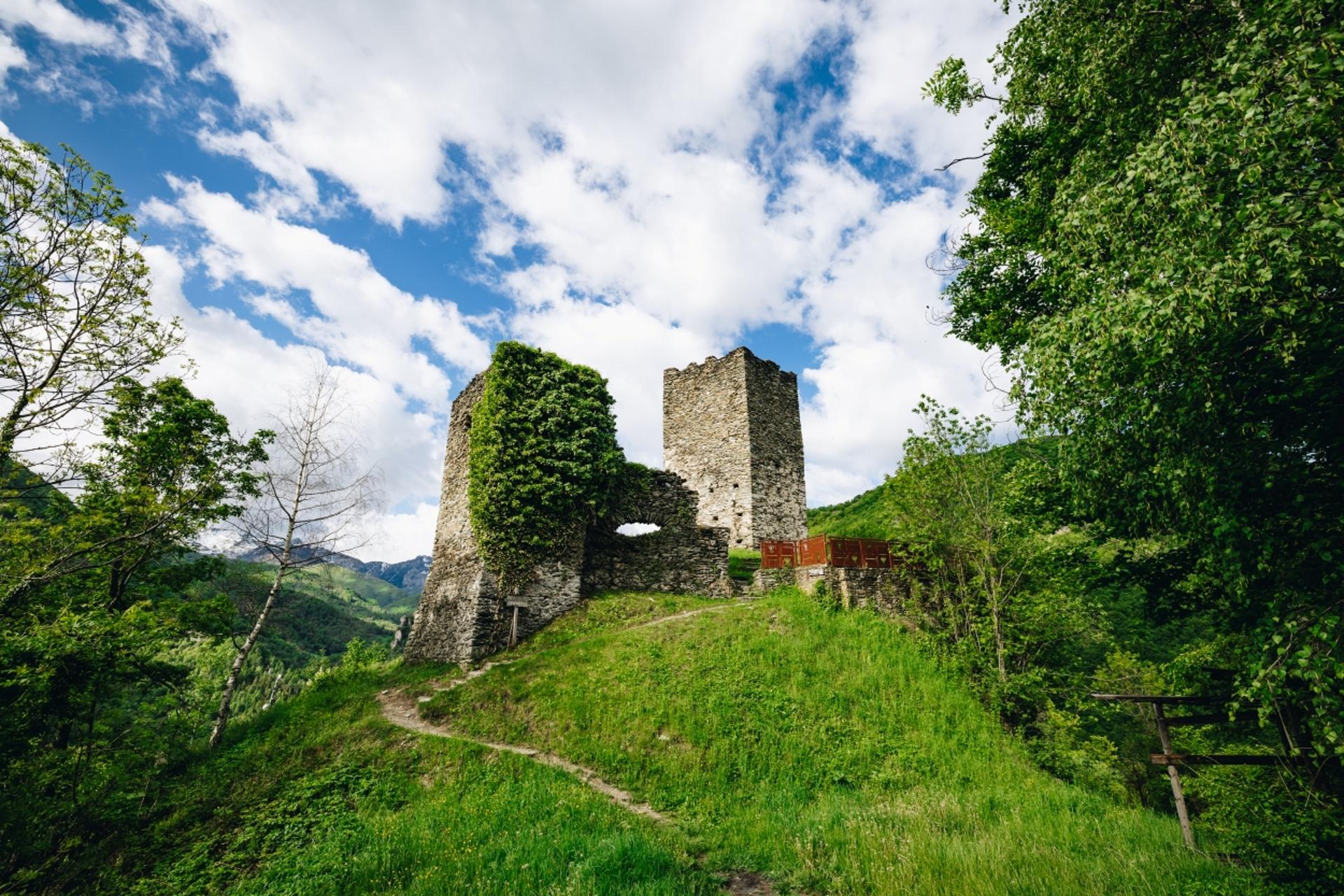
After passing below a mountain pasture, the trail briefly traverses a slope, after which it runs along a grassy ridge and then converges with a dirt road. A hundred meters further on, turn left and, with numerous turns, descend into the Bandito (Italian for “forbidden”) woods, a beech forest so called because, since the eighteenth century, the cutting of trees has been prohibited in order to protect the underlying village of Palanfrè from avalanches.
Much lower down, ignore a mule track that heads off to the right towards the Alberghi (or Albergh) valley, through which you will pass during the next stage. Continuing to the left, the road becomes paved as you pass by the houses of the village of Palanfrè (1,379 m, fountains), where Rifugio Arbergh is located.
Stage 2: Palanfrè–Trinità di Entracque by way of the Mena Pass
Ascent: approx. 840 m (2,760 ft)
Descent: approx. 1,120 m (3,675 ft)
Total length: approx. 16 km (10 mi)
Elevation at start: 1,379 m (4,524 ft)
Highest elevation: 2,201 m (7,221 ft)
Difficulty level: E (intermediate)
Head back along the final piece of the previous stage. At the first hairpin bend, leave the dirt road to take the mule track to the left that heads into the Alberghi (or Albergh) valley.
After a false flat through a lovely beech forest, you will reach Gias Piamian (fountain). Just a bit further on, ignore the old trail that continues to the right, which is now not recommended due to landslides. Instead, cross the stream bed on the left and climb through a beech forest with numerous switchbacks.
At the top, the trees thin out and fragrant dwarf pines begin to dominate the flora. After a short, flat traverse, head down a few meters to the right towards the stream bed. After crossing the stream again, you will be back on the original trail. Across from you, you will see, in all its splendor, the imposing rocky form of Frisson, which is not surprisingly nicknamed “Little Matterhorn”.
After a few hundred meters of false flat, the valley widens again. When you reach a fork in the trail, ignore the left branch that heads to Lake Albergh and continue to the right. The two trails run almost parallel to Gias Vilazzo (1,823 m), located atop a knoll.
Turn to the right and head up a grassy slope of the Guglielma summit, dotted with alder bushes, and pass the Reine fountain. The trail markings are not always obvious, but you will soon reach the basin where the enchanting lower Frisson lake is located (2,054 m), beneath the mountain of the same name, which is an excellent spot for a rest.
Take a trail to the right of the lake that, with a short but steep climb, leads to the Mena pass (2,201 m), located at the watershed with the Sabbione valley.
After passing a depression, the trail begins to descend as it traverses a steep, grassy slope. As you descend, the trail becomes easier until you reach a plateau beneath the majestic Rocca dell’Abisso. Here, an old mule track bordered by stones continues westwards and then continues to descend into a steep, grassy valley dotted with lovely mountain pines. The trail, which is little used but always well prepared, winds through a seemingly endless series of switchbacks but offers excellent views out to the southwest across the start of the Sabbione valley.
When you reach a fork (1,707 m), turn right. Once you have reached a grassy shoulder, descend diagonally to the left along a trail that has been cut up by livestock. After crossing the stream over a footbridge, follow a trail that is not super evident to the nearby Gias dell’Adreit (1,643 m). Once you have reached a dirt road used for livestock, follow this undulating road to the right near the stream, as you cross a broad plateau of the valley.
Once you have crossed the stream again on a footbridge (1,579 m), proceed towards the valley through a small beech forest and reach the clearing of Gias Valera (1,517 m), sometimes referred to as the lower Gias Valera. Behind you (to the southeast), Mount Frisson and Rocca dell’Abisso rise majestically.
As you descend, the beech trees become more and more dense, and the dirt road nears the stream, with its rivulets and small pools. After a more marked descent at the foot of the steep slopes of Costa Garbella, you will reach Gias Ischietto (1,357 m), where the valleys of Ischietto and Sabbione intersect with the Bousset valley.
Ignoring all the side trails, continue along the comfortable main road that descends gently through bands of beech trees, through which the rugged peaks that delimit the valley to the west can be seen from time to time.
Once you have crossed the narrow Suffiet stone bridge (1,184 m), continue descending and, after a kilometer and a half (about a mile), return for the last time to the right side over the Porcera bridge (1,078 m). The road becomes paved, passes the houses of Porcera (fountain) and, after a short climb, reaches Trinità and its chapel, where this amazing itinerary comes to an end.