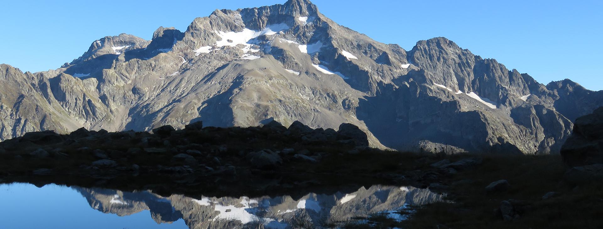
ENTRACQUE, VALLE GESSO
TOUR OF GELAS
approx. 35,5 km (22 mi)
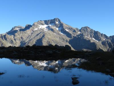
A three-day outing through Italy and France around the Gelas massif, known as the “Mont Blanc of the Maritime Alps” for its grandeur and for the glaciers that surround it, albeit now in significant retreat. This is an amazing itinerary through nature parks, glacial valleys, high-elevation passes, alpine lakes, vast rocky expanses, and what remains of the southernmost glaciers in all the Alps, located just a few dozen kilometers from the sea as the crow flies.
Due to the high elevations, patches of snow often remain into early July. When there is snow, crampons may be essential and the difficulty level increases significantly.
It should be noted that the mountains are an environment subject to constant change and conditions that can vary depending on the weather, the season, climate change, and human influence. The authors and ATL del Cuneese (the Cuneo board of tourism) decline any responsibility for any injury or other harmful consequences deriving from use of the information provided. Each itinerary is to be followed at your own risk.
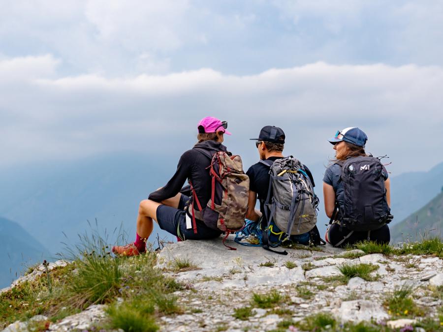
The Stages
the route
No result found
No result found

Discover
more
Start: San Giacomo di Entracque
Stage 1: San Giacomo di Entracque–Rifugio Pagarì
Ascent: approx. 1,440 m (4,725 ft)
Total length: approx. 11.5 km (7 mi)
Elevation at start: 1,210 m (3,970 ft)
Highest elevation: 2,627 m (8,619 ft)
Difficulty level: E (intermediate)
Cross the Gesso della Barra river and continue along the paved road that climbs through hairpin bends into the extensive Moncolomb valley becomes a dirt road near the former royal hunting lodges (1,250 m).
Climb steadily among beech trees past Gias dell’Aiera (1,349 m). A little higher up, you will reach the start of the large, lovely Pra del Rasur (1,435 m). In the background, you can see Mount Clapier, the southernmost three-thousander (elevation: 9,990 ft) of all the Alps.
Walk along the entire plateau (about a kilometer and a half long) with gentle ups and downs to the pasture at Vei del Bouc (1,430 m). Ignore the fork to the left in the direction of the Vei del Bouc valley, and continue along the grassy dirt road. After crossing the stream over a walkway, continue on the opposite side along an easy mule track that runs south in a modest but constant climb.
After a number of walkways that help you cross a swampy stretch, ignore the fork to the right for the Pantacreus valley and use the stones (or, if necessary, a wooden bridge a little higher up, but which is not particularly easy to reach) to cross the stream of the same name, then climb through the pasture’s numerous switchbacks.
The trail stretches to the south and passes the pasture at Muraion (1,856 m) and the rocky outcrop of the lower Muraion pass (2,050 m). Technically speaking, the term “pass” is not appropriate since it’s not the lowest point between two mountain ranges.
After a few more switchbacks, the view suddenly opens up over the high valley. Just beyond, you will find the cool waters of the “donkey fountain” and what remains of the upper Muraion pasture (2,090 m). The mule track continues, eventually passing the spring of the last green alder after which, at an elevation of 2,278 m (7,474 ft), you will pass a fork to the left in the direction of Lake Bianco dell’Agnel.
Here, there begins a seemingly endless series of very long switchbacks. After a hard-fought three hundred meters of elevation gain, a pile of stacked stones announcing your approach to Rifugio Pagarì (2,627 m, fountain at the back) finally appears, but the shelter itself emerges only at the last. Pagarì was the nickname of Paganino dal Pozzo, a merchant who, in the first half of the fifteenth century, subsidized the mule track, originally a part of the ancient Salt Road, which leads from San Giacomo di Entracque to what came to be named the Pagarì Pass in his honor.
Stage 2: Rifugio Pagarì–Refuge de la Madone de Fenestre
Ascent: approx. 580 m (1,900 ft)
Descent: approx. 1,320 m (4,330 ft)
Total length: approx. 9.5 km (6 mi)
Elevation at start: 2,627 m (8,619 ft)
Highest elevation: 2,798 m (9,180 ft)
Difficulty level: EE (expert)
Just below the shelter, take a trail to the right (left going uphill) that heads south through debris and smooth rock formations.
Follow a few red markings and cairns (the trail is not always easy to spot) to quickly gain elevation. Once above 2,700 meters (8,860 ft), you will reach a wide, rocky ridge overlooking a secluded, debris-filled depression. Looking back, you can enjoy spectacular views out over the severe northeast wall of Maledia, as well as Caïre del Muraion, separated by the steep Maledia couloir.
Continue south along an easy traverse until you join up with the remains of an old military mule track. Ignore the fork to the Pagarì summit on the left and turn right, losing about twenty meters of elevation and then climbing again up to the Pagarì Pass (2,798 m), the highest point of the entire excursion. Much lower to the south, you can see a portion of Lac de la Fous, just above which is Refuge de Nice.
Continue down into France through Vallon de Pagarì and enter the protected Mercantour National Park. With a steep descent, you will reach a hollow and pass the Lacs du Mont Clapier (2,535 m), small twin pools of water where the trail passes in between, and finally you will reach Refuge de Nice (2,232 m), which you will bypass slightly to the left on a rocky slope.
The trail runs along the western shore of Lac de la Fous (2,180 m). Once you reach the dam, continue downhill until you find a signpost for Pas du Mont Colomb. Ignore the trail that descends into Vallon de la Gordolasque and take the fork to the right.
The recently restored trail climbs steeply and leads to a vast, debris-filled hollow. Continue towards the evident cut through the center of the valley and a narrow and steep stone gully to the impressive, rocky Pas du Mont Colomb (2,548 m), located between Caïre Colomb and Mont Ponset. This is the most challenging section of the entire excursion.
Descend into the opposite valley through expanses of debris flows, crossing a hollow with an unnamed lake and cutting across the debris on the slopes of Caïre de la Madone. On the opposite side here, you can identify the way up to Col de Fenestre, which you will pass on the third stage.
With further turns, you descend to Vacherie de la Madone, where you cross the Vésubie stream on a walkway. A short ascent takes you to the small sanctuary of Madone de Fenestre and to the shelter of the same name (1,910 m).
Stage 3: Refuge de la Madone de Fenestre–San Giacomo di Entracque
Ascent: approx. 580 m (1,900 ft)
Descent: approx. 1,280 m (4,200 ft)
Total length: approx. 14.5 km (9 mi)
Elevation at start: 1,910 m (6,270 ft)
Highest elevation: 2,474 m (8,117 ft)
Difficulty level: E (intermediate)
Take the wide mule track behind Refuge de la Madone de Fenestre. At an elevation of 2,067 m (6,781 ft), ignore a first fork to Pas de Ladres on the left.
Follow the trail that crosses two streams and winds through increasingly sparse larch trees up Vallon de la Madone de Fenestre. Arriving at the beautiful Lac de Fenestre (2,266 m), skirt its eastern shore and wind up towards a military shelter with two works of the Alpine Wall in the vicinity.
Ignore a fork to the left and merge onto the mule track that connects Pas des Ladres with the now nearby Col de Fenestre (2,474 m). Turn right and reach it after a few switchbacks. Just above, a small, concrete observation post is clearly visible.
After the armistice of September 8, 1943, roughly a thousand Jews from Saint-Martin-Vésubie, convinced they would find refuge in Italy, descended from here and from Colle di Ciriegia towards Entracque and Valdieri, respectively. But luck was not on their side. Three hundred and forty-nine of them were captured and locked up in the Alpine barracks of Borgo San Dalmazzo. They were later deported to Auschwitz where only eighteen survived.
Returning to Italy, zig-zag down to a barracks, which is now a shelter for a group of ibexes. The mule track traverses a debris-filled hollow. At an elevation of about 2,350 m (7,700 ft), ignore a fork to the right that leads to an old hunting post.
The military track becomes impressively wide as it winds through the debris at a modest slope. Once on a plateau, it’s worth taking a short detour (attention: it’s not very visible because there is only a cairn marking it) to the nearby Praiet Lake, a small and little frequented pool of water nestled in a grassy, debris-strewn hollow at the foot of the steep slopes of Gelas and of the Saint Robert summit.
Back on the trail, continue zig-zagging up the slopes of the Lombard summit. The trail remains on the severe rocky gorge of Valletta beneath the looming mass of Gelas and rounded rock formations. Near the dilapidated barracks Testata Gesso della Barra, ignore the fork that heads in that direction and continue to the left on the main mule track. Much lower down, ignore the branch to the right towards Glacier Pass (Passo dei Ghiacciai).
The wide trails continues with grassy and stony stretches as you descend towards the Praiet floodplain, which has been radically altered by the latest high-water periods of this river. Follow as best you can a few cairns to reach the dirt road to the nearby Rifugio Soria-Ellena, which you will bypass slightly to the right on a hill.
Follow the access road downhill for a few hundred meters. Near the small winter shelter, cross the Gesso della Barra stream on a wooden walkway to the left bank. Ignore the fork to the left to Col de Fenestrelle and cross two lateral streams.
The dirt road, with a very rough surface, continues through hairpin bends (with possible shortcuts) down to a plateau overlooking a narrow valley, at the end of which it descends again through another endless series of switchbacks and long traverses. When you reach Piazzale dei Cannoni, from which you will have an excellent view to the southeast towards Mount Gelas and what remains of its glaciers, the surface will improve.
Follow the long but comfortable dirt road that descends towards the valley and past Gias Isterpis. On the left, you can see the waterfalls made by the streams that flow down the steep slopes of the Ciamberline and Fenestrelle peaks. Continuing on, you will find the first trees that announce a dense beech forest. You will soon be back in the village of San Giacomo, where this magnificent outing ends.