ORMEA, ROCCAFORTE MONDOVI, VALLE TANARO, VALLI MONREGALESI
MONGIOIE
26,5 km
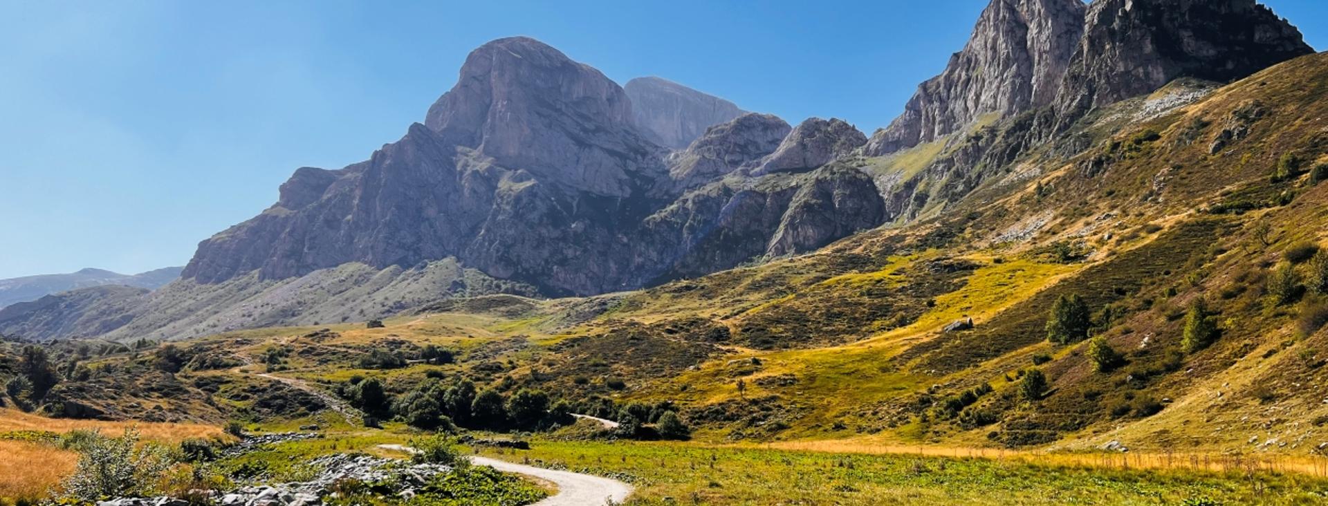
Mongioie is the second highest peak in the Ligurian Alps after Marguareis. It’s a mountain that has three very different faces. The west face features grassy slopes dotted with whitish rocks shaped by water gently descending towards the Marchisio plateau, whereas the southeast face consists of fantastic dolomitic limestone outcrops overlooking Viozene. The northeast face, finally, plummets vertiginously downward for four hundred meters (1,300 feet) to Lake Raschera.
Difficulty level
EE/E
Distance
26,5 km
Starting altitude
1634 mt
Lowest / Highest point
2407
Season
SUMMER
Targets
SPORTSPERSON
Descending from the Saline Pass towards lower Carnino and continuing through Colla di Carnino, you can avoid the highly demanding descent into the steep Gola delle Scaglie.
No result found
No result found


Discover
more

With this two-day excursion, broken up into well-balanced stages, you will go all the way around this mountain through highly diverse environments. It’s a route recommended for expert mountaineers due to the demanding descent into a steep gorge, Gola delle Scaglie, although this can be bypassed by way of Carnino.
Given the relatively low elevations, the ideal months for this outing are June and September. (Rifugio Mongioie usually opens at the beginning of May and closes at the end of October). We recommend avoiding the months of July and August, which are characterized by intense heat and more people on the trails.
Stage 1: Pian Marchisio–Rifugio Mongioie by way of the Saline Pass
Ascent: approx. 840 m (2,760 ft)
Descent: approx. 900 m (2,950 ft)
Total length: approx. 12 km (7.5 mi)
Elevation at start: 1,634 m (5,360 ft)
Highest elevation: 2,407 m (7,897 ft)
Difficulty level: EE (expert)
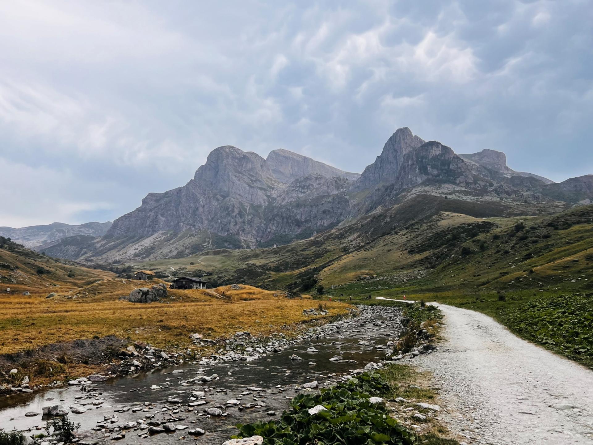
From the entrance at Ponte Ciappa (1,624 m, or Porta di Pian Marchisio), the last opportunity for parking, head slightly downhill to the magnificent Pian Marchisio. Here, fairly obviously, you will follow the dirt road that winds nearly flat through beautiful meadows, dotted, in late spring, with a great many colorful flowers. Continuing along the stream, pass by the Ciappa saddle. After passing numerous streams, all tributaries of the Ellero river, you will begin a short ascent through a series of switchbacks (with possible shortcuts).
When a grassy trail breaks off to the right, in the direction of the now nearby Rifugio Havis de Giorgio Mondovì, ignore this trail and continue along the dirt road. Three hundred and fifty meters (1,150 feet) beyond, you will reach another fork, where you will continue straight across the bridge in the direction of Gias Gruppetti.
Continue for a long stretch of false flat. When the road begins to climb again, two hundred meters beyond a hairpin bend, abandon the road and turn onto a trail to the right (follow directions for Passo delle Saline). Soon you will reach a beautiful grassy plateau and the Tumpi sinkhole, a significant geological feature where the water is swallowed up by the earth.
Following stakes and red markings, cross a grassy mound and then enter a basin, at the end of which a steep ramp begins and leads to the Saline Pass (2,177 m), from which you can enjoy amazing views out over the ridge of the Saccarello, Missun and Bertrand mountains. The name “Saline” derives from an ancient salt route that came right over this pass.
Ignore the trail that descends towards Carnino (which could be an easier variant) and the tracks to the right that lead to the Saline summit, and turn left (southeast) along a beautiful grassy ridge.
After circling to right of a knoll and descending slightly, the trail again heads up a steep grassy slope between two rock formations. A strenuous will bring you to a shoulder of the mountain and the start of a spectacular, grassy ridge with excellent views to the northwest out over the Saline summit and the omnipresent Monviso and to the west towards the Bego, Grand Capelet, Clapier and Gelas mountains.
Continue along the ridge that will take you in a semicircle to the top of Pian Comune (2,367 m), where the view extends as far out as the Ligurian Sea. Continue on to the nearby summit of the Colme Ovest (2,407 m), the highest point of the entire excursion, after which the trail, winding through expanses of edelweiss flowers, loses about seventy meters of elevation.
With a few ups and downs over hills and through basins, head towards the top of the Colme Est (2,378 m). Just before the top, turn to the right into the furrow known as Bocchino delle Scaglie (2,325 m).
Here is where the most challenging stretch of the itinerary begins: the descent to the south in the scenic gorge Gola delle Scaglie. Staying close to the spectacular limestone towers known as Bricchi Neri that delimit the left side, descend steeply while paying close attention to the unstable surface.
The trail, which is not always obvious, shifts to the right lower down. The trail seems to improve, only to worsen again, turning into a very steep debris chute that ends on grassy meadows a hundred meters further down.
At this point, it’s important to resist the temptation to continue along the trail that appears to continue in the direction of the alpine shelter, since it unexpectedly ends a little further on. Instead, turn to the right in the direction of a mountain pasture that would appear to lengthen the route a bit.
Once you find the trail, pass a debris chute and continue along the right side of it for a lengthy stretch as you quickly lose elevation.
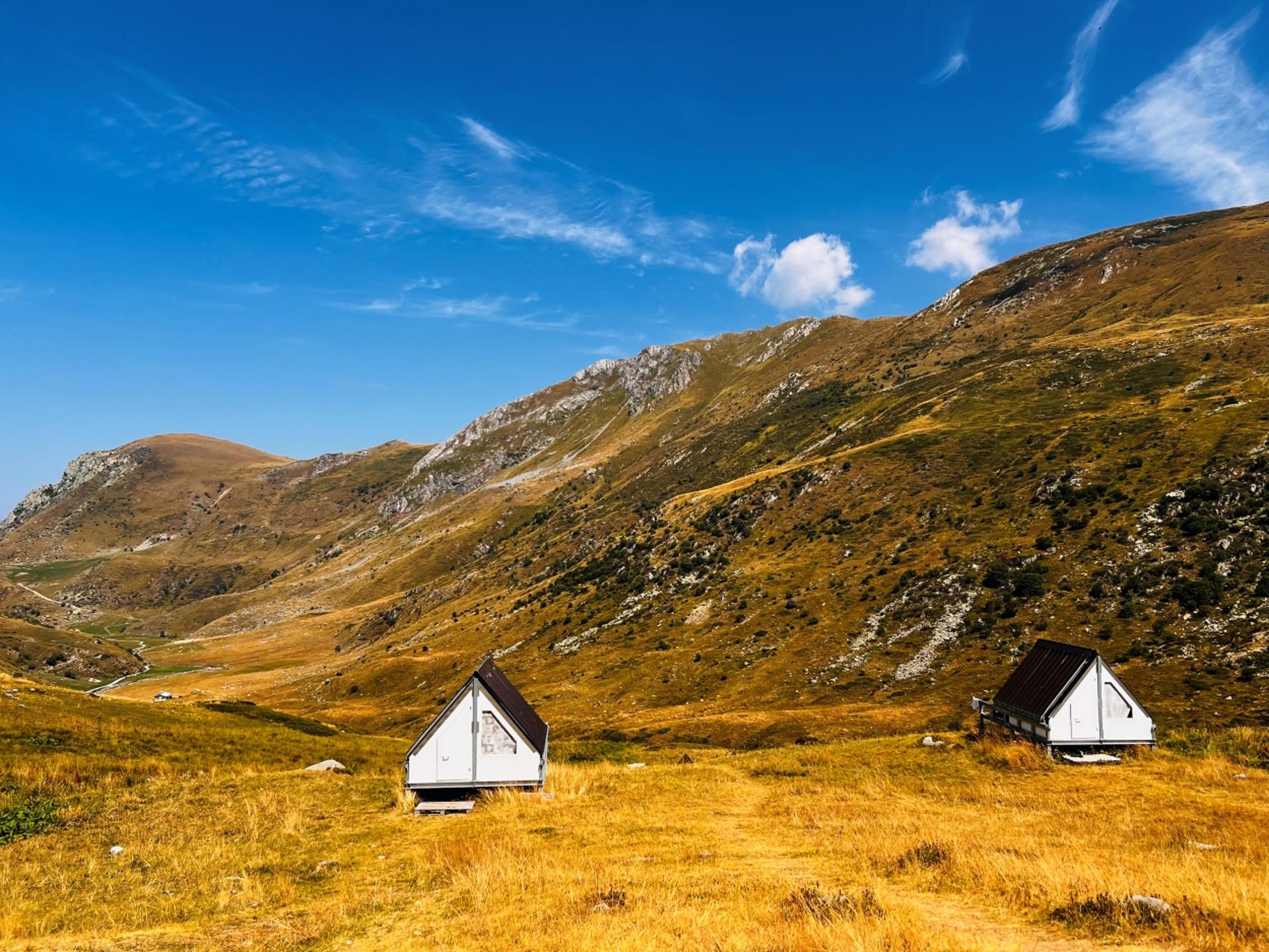
After this long stretch, and having entered a pine forest that surround the shelter, you will find a mule track bordered by dry stone walls that leads to Rifugio Mongioie (1,550 m, fountain), situated on a panoramic plateau.
Stage 2: Rifugio Mongioie–Pian Marchisio by way of Bocchino d’Aseo
Ascent: approx. 1,030 m (3,380 ft)
Descent: approx. 970 m (3,180 ft)
Total length: approx. 14.5 km (9 mi)
Elevation at start: 1,550 m (5,085 ft)
Highest elevation: 2,329 m (7,640 ft)
Difficulty level: E (intermediate)
Follow the route of the previous stage for a short stretch, flanking Rifugio Mongioie to the right (1,550 m), and climb behind it among the pine trees.
Leaving the debris chute on the left from where you arrived, continue along a mule track that converges with a dirt road a few dozen meters ahead. Follow this road in a steep climb to the left. Higher up, this dirt road narrows and continues as a very steep trail.
Once out of the trees, ignore a fork that continues straight, almost flat, which will end a little further on. Instead, turn left on the trail (attention: not very evident) that zig-zags around a rocky barrier from above.
Continue up a grassy slope, approaching the steep slopes of Rocca Garba, and, after a lengthy ascent through the scrub, traverse to the stunning prairie known as Pian dell’Olio (2,083 m, spring just before to the right of the trail). From this point, the landscape opens out towards the start of the valley, and you really see now what karst terrain is all about.
The trail continues along more moderate slopes, first on grass and then in an area dotted with large limestone boulders. After passing through a narrow bit, shift to the right side and continue briefly to Bocchino d’Aseo (2,295 m), a watershed for the Raschera valley, which branches off of the Corsaglia valley.
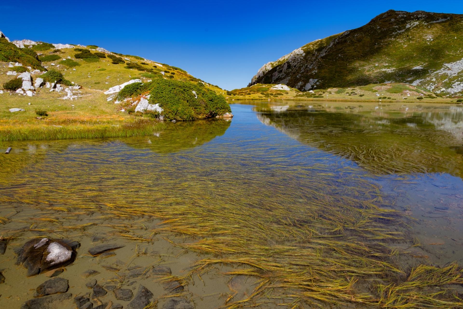
Descend from the opposite side, ignoring a trail almost immediately to the right in the direction of the Revelli saddle (attention: there are no markings). Continuing left among the rhododendrons, traverse to Lake Raschera (2,109 m), a small, secluded body of water at the foot of the steep northeast wall of Mongioie.
Continue north along a little-traveled trail that runs along the eastern shore of the lake. Ignore a fork to the right towards the Raschera saddle, and continue along the trail that bends to the left through lovely grassy slopes. The trail steepens and soon you will reach Bocchino della Brignola (2,276 m), located between the summit of the same name (on the left) and the Ferlette summit (on the right), from which you can enjoy excellent views of the glacial basin and the stunning Brignola lakes.
Descend in a steep zig-zag in the direction of the lakes. At the first fork (2,181 m), ignore a trail to the main lake on the right (the others are now reduced to peat bogs) to follow a traverse to the left, first downhill and then uphill, that cuts across the rocky slopes of Cima Brignola.
Having crossed a stream several times, make a semicircle along a beautiful grassy meadow. Rising steeply among the rhododendrons, continue alongside a tiny body of water and continue until you reach Colle Brignola-Seirasso (2,329 m), the highest point of the stage, from which you will return to the Ellero valley. The view from here extends from Mount Mongioie to the Saline summit, with Marguareis to the right in the background.
Following the trail to the right, begin the descent of the grassy slopes, which are used as pastures (beware of guard dogs). The trail cuts across various livestock trails and is not always very evident, but just use the Gias Gruppetti shelter (1,862 m) as a reference.
Once you have reached the dirt road, all you have to do is follow it back to your car.
esempi di as xml: xml serveResource con templateId (chiave)
esempi di as json: json serveResource con templateId (chiave)
esempi di as json e siteId: json serveResource con siteid
en_US
What
to do
en_US
Experiences
No result found
en_US
Where
sleeping
en_US
Offers
en_US
Info


