VALLE STURA, VINADIO
BAGNI DI VINADIO - SANT'ANNA DI VINADIO
approx. 22 km (13,6 mi)
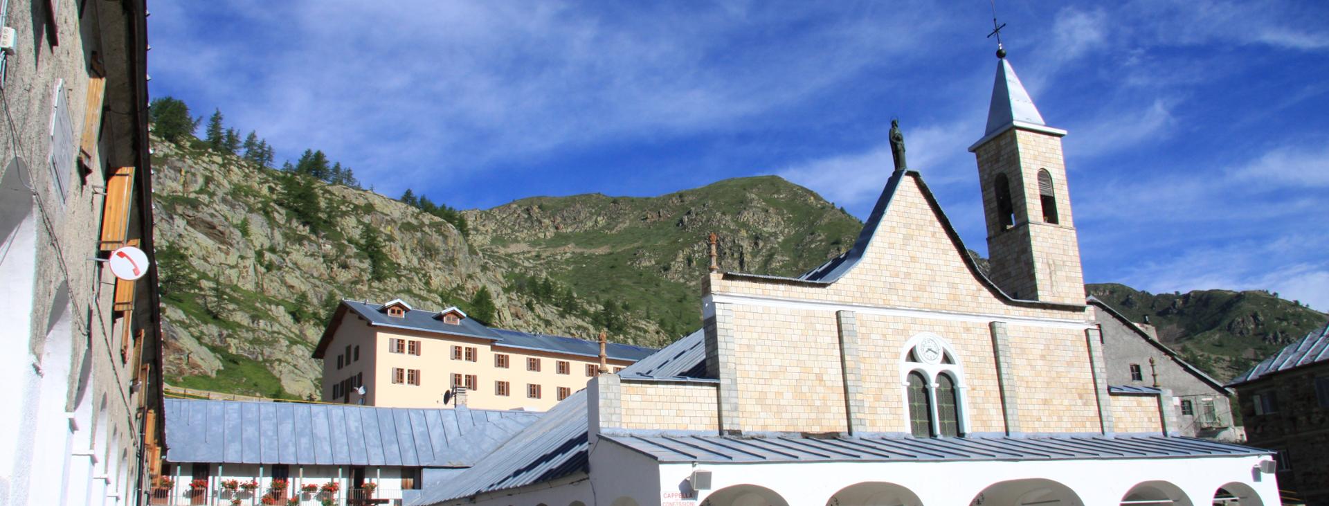
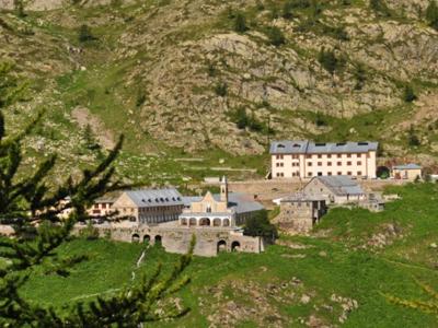
A two-day outing that makes a wide loop through Sant’Anna di Vinadio, a popular spot with the locals and home to one of the highest-elevation sanctuaries in Europe. This itinerary is a much more interesting alternative to the traditional route taken by pilgrims, who typically follow the paved road on foot. On day one, you will head up the secluded Insciauda valley along the route of the Grande Traversata delle Alpi (GTA) to the panoramic Bravaria pass, returning on day two by way of the beautiful Roccias Lion suspended valley and then through the extensive Tesina valley. The most physically fit can complete the loop in one day, but we recommend splitting it into two stages, staying at the spartan Rifugio San Gioachino shelter located just above the sanctuary.
Difficulty level
E (intermediate)
Distance
approx. 22 km (13,6 mi)
Starting altitude
1281 mt
Lowest / Highest point
2,393 m (7,850 ft)
Season
SUMMER
Targets
SPORTSPERSON
The itinerary should be no earlier than late June or early July, when the snow has melted at the top of the steep Roccias Lion valley.
It should be noted that the mountains are an environment subject to constant change and conditions that can vary depending on the weather, the season, climate change, and human influence. The authors and ATL del Cuneese (the Cuneo board of tourism) decline any responsibility for any injury or other harmful consequences deriving from use of the information provided. Each itinerary is to be followed at your own risk.
No result found
No result found


Discover
more

Start: Strepeis (Vinadio)
Stage 1: Bagni di Vinadio–Sant’Anna di Vinadio by way of the Bravaria Pass
Ascent: approx. 1,070 m (3,510 ft)
Descent: approx. 360 m (1,180 ft)
Total length: approx. 9.5 km (6 mi)
Elevation at start: 1,281 m (4,200 ft)
Highest elevation: 2,319 m (7,608 ft)
Difficulty level: E (intermediate)
From the Strepeis car park, cross the Corborant river across the wooden walkway. From the opposite side, take the dirt road that descends slightly to the left. Ignore a first side road to the right and, roughly in front of the thermal spa, take the road that leads to the right (small signpost) in the recessed Insciauda valley.
This first section is not particularly interesting. The dirt road climbs very steeply in the dark valley among firs, beeches, mountain maples and rowans alongside a terraced stream with drops built in so as to lessen its slope. Higher up, larch trees dominate the flora.
After five hundred meters (1,600 ft) of elevation gain, you will gross the stream. Here the dirt road ends, and a much more enjoyable trail begins and rises through open ground among larches, rhododendrons, and berries.
At an elevation of about 1,950 meters (6,400 ft), ignore a side road to the right and continue to the left as the larch trees continue to thin. You will then head through a number of beautiful, grassy hollows with excellent views behind you out over the arc of summits ranging from Corborant to Rocca la Meja and including Mount Laroussa and Becco Alto del Piz.
After a final grassy hollow with a few pools of water, the trail continues steeply down to the now nearby Bravaria pass (2,319 m). To your left you have the rocky Bravaria spire and Mount Steliere, but the view is monopolized by the narrow Maladecia spire and the high valley of Sant’Anna, at the top of which you can see the sanctuary of the same name, your destination for this first stage.
The trail continues along the opposite side, starting out narrow and slightly exposed, with an unpleasant surface of slippery gravel. Fortunately, the trail improves quickly and makes a lengthy traverse about halfway up the valley wall with a few ascents. This is a beautifully panoramic stretch looking out over the valley floor below.
Heading downhill, skirt the small Mouton Inferiore lake (2,147 m), then continue along the lovely trail that, much further on, heads down and crosses a stream. After climbing a stretch that is terraced with wooden logs, you will soon reach a paved road that leads to Sant’Anna di Vinadio.
Turning left, descend in the direction of some cabins and the Rifugio San Gioachino shelter, located just above both the sanctuary (2,010 m) and what was once the house of the caretaker who resided here in summer and winter months to assist pilgrims and offer them shelter but is now a multipurpose room.
Stage 2: Sant’Anna di Vinadio – Bagni di Vinadio by way of the Tesina Pass
Ascent: approx. 380 m (1,250 ft)
Descent: approx. 1,090 m (3,575 ft)
Total length: approx. 12.5 km (8 mi)
Elevation at start: 2,010 m (6,595 ft)
Highest elevation: 2,393 m (7,850 ft)
Difficulty level: E (intermediate)
From the sanctuary, take the paved road that rises to the south (possible shortcut here) to a clearing with a huge, erratic boulder where an apparition is said to have occurred, on the top of which is a statue of Saint Anne. Legend has it that the Virgin Mary’s mother appeared to the shepherdess Anna Bagnis on this very spot.
Continue along the World War I military road, with its very choppy surface. Two hundred meters on, leave this road and turn right to follow a piece of the traditional lakes loop in reverse. Six hundred meters (about 2,000 feet) further on, you will reach a lovely pool of water, which is typically dry in the summer, with a large, erratic boulder on one shore. This is not yet the larger Sant’Anna Lake (2,167 m), which is just a bit farther on and is followed by a third, smaller pool of water.
Continuing along the military road (with possible shortcuts), you will enter a secluded valley and take a few switchbacks to reach the Tesina Pass (2,393 m), the highest point of the excursion.
Past the trail carved into the rock to the left in the direction of the Saboulè pass, begin the descent in the opposite direction into the Roccias Lion valley, a secondary valley above the subsequent Tesina valley. A mule track descends decisively towards a beautiful, unnamed pool of water, flanked by a few Swiss pines (caution: patches of snow could remain along this stretch into early summer).
Once near the lake, the trail tends to disappear. To get around a marshy area, you will need to go back a hundred meters or so and, after a stream, turn to the right and make a slight climb to a stunning, secluded green hollow, where the trail becomes more evident again.
A little further on, the Roccias Lion valley ends suddenly, and you have to descend decisively to the left into the Tesina valley below. When you reach the gully, cross the stream across a wooden walkway and continue immediately afterwards along a trail to be followed downhill to the right.
The trail flanks a mountain pasture with the green-roofed Tesina hut (1,948 m) next to a large, erratic boulder. At the bottom of the plateau, you return to the woods then continue along the trail that follows the left bank of the Tesina river. The valley shrinks and dips, as a lengthy trail descends among the larch trees, which gradually give way to spruce, rowans, laburnums, and then beech trees.
Once you reach the first of the Callieri cabins (1,435 m), the trail widens into a dirt road. Continue down and cross the stream over a bridge, after which the road surface turns to asphalt. Two hundred meters farther on, you will join a road that connects Strepeis with San Bernolfo. Follow this road in a slight, constant descent alongside the Corborant river (alternatively, you could take a parallel dirt road that runs uphill from the paved road).
After about two and a half kilometers (1.5 miles), you’ll be back in Strepeis, where this amazing itinerary comes to a close.
esempi di as xml: xml serveResource con templateId (chiave)
esempi di as json: json serveResource con templateId (chiave)
esempi di as json e siteId: json serveResource con siteid
en_US
What
to do
en_US
Experiences
No result found
en_US
Where
sleeping
en_US
Offers
en_US
Info
