GAIOLA, VALLE STURA
PARALOUP RING IN MTB FROM GAIOLA
21,5 km
A splendid ring trail in the wonderful lower Valle Stura to cover on your mountain bike or e-bike. A tour forming part of the Tajaré Bike Park, characterised by a very “flowing” descent, along one of the longest single-tracks in the entire Stura Valley. Nevertheless, the uphill section also proves exciting: the passage through the striking villages of Tetti Forno and Pollino, the many community bakehouses, a stopover in the beautiful rest area of the Chiot Rosa and the now legendary Borgata Paraloup, an open-air museum and pulsating testimony of the Resistance, make this ring trail an all-round experience waiting to be pedalled.
Please note that itineraries may include roads where motor vehicles are allowed. Authors and trail testers are not responsible for the information contained.
The Stages
the route
No result found
No result found
Discover
more
The complete route facing you is about 22 km long, with an elevation gain of about 750 metres. It is an itinerary that we recommend you tackle with a front or full MTB or e-bike as the terrain it features is mostly unpaved. A very scenic loop on dirt roads with regular surfaces and truly spectacular trails.
The route starts from Gaiola, in the lower Stura Valley. Here, you take the provincial road and begin climbing in the direction of Rittana on asphalt. After a few kilometres, you reach the hamlet of Castelletto: here you have to turn left and keep climbing towards Rittana, still on an asphalt surface with gentle slopes. We recommend a visit to the centre of the small town to admire the local houses with alpine architecture. These preserve frescoes on the walls linked to the popular religious tradition.
After crossing the small village of Rittana, continue on the paved road for another 4 km, ignoring any detours.
At kilometre 4.7 from the starting point, where the road makes a hairpin bend to the left, leave the main road and continue on a paved road that runs along a small stream. Going up, about 600 metres further on, you’ll come to another hairpin bend on the left. Follow it but pay attention: here the slope increases and the road becomes steeper.
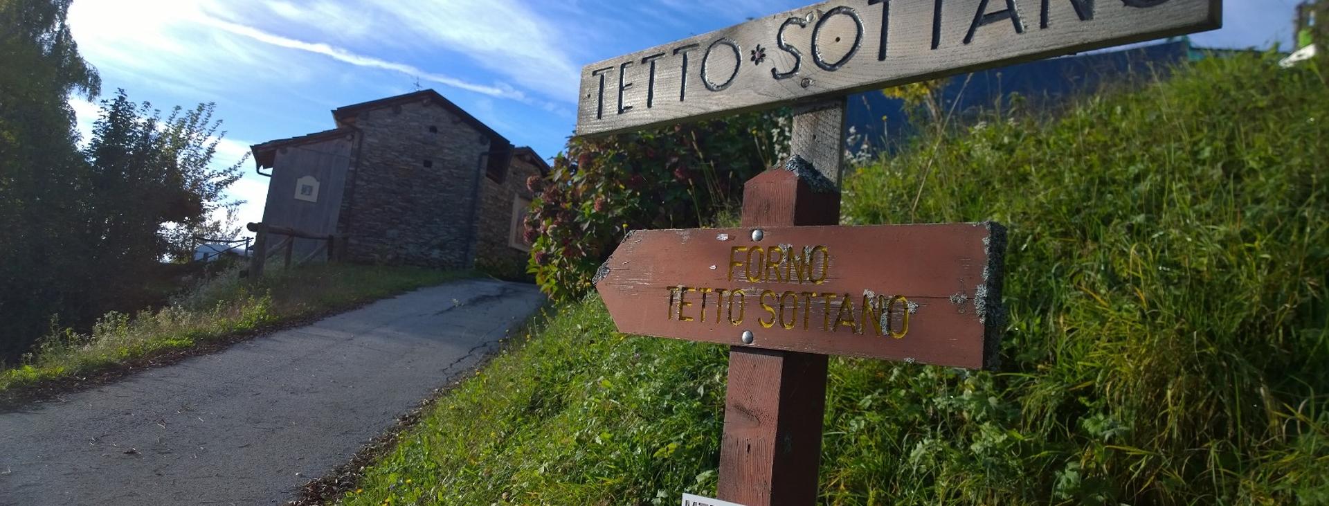
Keep going until you reach Tetti Forno. We recommend a quick tour of the small village with its wonderful view of the surrounding mountains, cool fountain and, above all, the fresco of “Notre Dame de Laghet” dated 1894 located there. Set off again and two tight curves will immediately take you up a steep and spectacular uphill ridge, as far as Borgata Castellar.
From here resume your ride without ever turning off the uphill asphalt road that will take you to the next village, from where you can admire Mount Tajaré. After the village, you will be faced with a short stretch, turning left, on a dirt track. You are now located at approximately kilometre 6.8 of your tour.
Continue on the dirt road deep in the woods from which, by turning your gaze to the left, you can admire the backdrop of the Maritime Alps: a long section awaits you on which you should ignore all the crossroads until you reach Chiot Rosa, a grassy expanse that was the scene of many battles and clashes in the past.
Cross it and take the paved road at the other side, climbing in the direction of Paraloup, a museum-like village that was the cradle of the Cuneo Resistance. The highest village of the municipality stands at an altitude of 1,360 metres in a panoramic position, so isolated that it must be “defended from wolves”, as its name suggests. Between autumn 1943 and 1944 it was the seat of the first partisan group “Justice and Freedom”, in which the commanders Duccio Galimberti, Dante Livio Bianco, Nuto Revelli and Miche Berra served.
From Paraloup, keep going and take the trail that passes behind the village and climbs steeply in the direction of a thick pine forest. Alternating plateaus and climbs, you will soon reach the highest point of the ring trail: a junction at about 11.4 km of your tour, the point where the orange and yellow routes of the Tajaré Bike Park meet up.
Continue on a spectacular descent that forks after about 1 km: keep to the right of the trail, which rises slightly then continues for another kilometre of descent, always on a single track, until you reach a crossroads on a dirt road. Turn left and continue downhill to another intersection where you will find a memorial stone in front of you. Take the trail to the right and ride along a few kilometres of ridge ignoring any detours you encounter along the way. After a stretch with some climbs, the path turns sharply to the left and ends after a descent in an open space among the trees. At the beginning of this area, take the steep path on the right, which continues on a very fast dirt road with a series of narrow curves in repetition.
Once past these, leave the road, taking the path on the left that leads you to the small village of Bricaiot. From Bricaiot, you can also take the flat trail on the left that leads you to the Croce della Vaita, a very panoramic point that can be reached with a 5-minute detour.
In the final part of the itinerary you will have to take the downhill trail that flanks the wall until you reach the junction just below the village. From here, take the steep trail on the right that will soon lead you firstly on to a comfortable dirt road and then on a paved road to Gaiola, the arrival point of the tour.
Download Cycling and Cycling Tourism Itineraries in the Province of Cuneo