CEVA, GARESSIO, PAMPARATO, SAN MICHELE MONDOVI, VALLI MONREGALESI
IN THE VALLEYS OF KING CARLO ALBERTO, BETWEEN PAMPARATO AND CEVA, PASSING BY THE CASTELLO DI CASOTTO AND GARESSIO
108 km
A panoramic itinerary that develops around the Monregalesi Valleys. A tour to be tackled on the road bike, on very scenic secondary roads. Ascents and descents will introduce you to villages, towns and breathtaking views. Put yourself and your limits to the test: a road route suitable for trained cyclists.
Please note that itineraries may include roads where motor vehicles are allowed. Authors and trail testers are not responsible for the information contained.
The Stages
the route
No result found
No result found
Discover
more
The route is about 108 km long from start to finish, with an elevation gain of over 2,500 metres. It is a circular itinerary that departs and arrives at the same point. A high mountain road where your hard work and sweat are rewarded by the pristine beauty of the landscapes and the wealth of nature waiting to be admired.
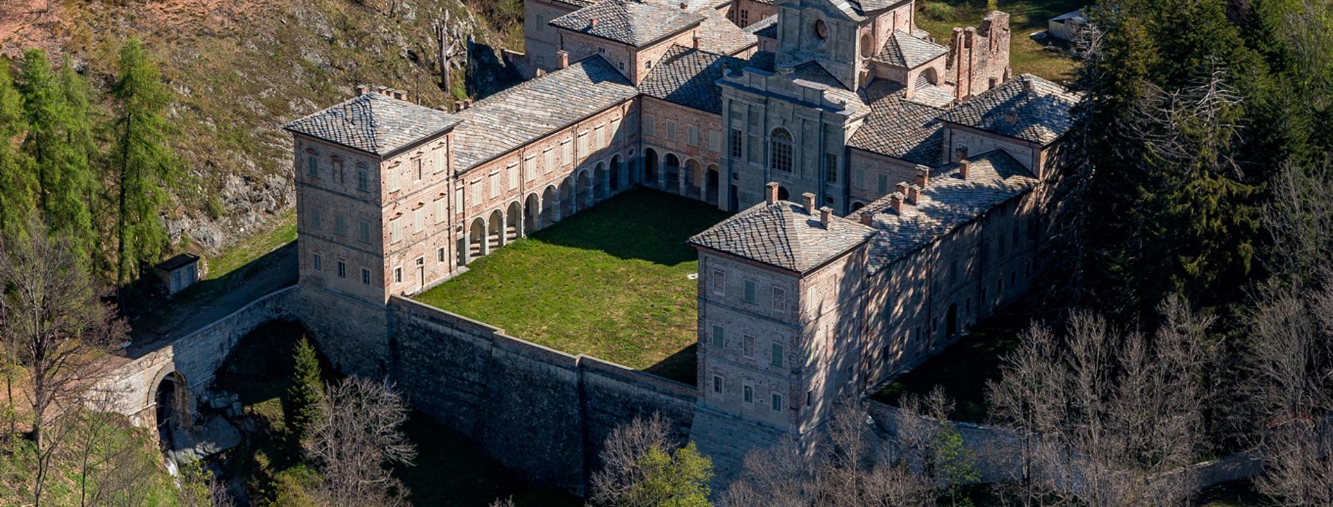
The route starts from San Michele Mondovì, and then develops along the Valcasotto, where you can admire the splendid hunting lodge as well as the castle of the same name, commissioned by King Carlo Alberto of Savoy. From the starting point of the route, the service area in San Michele di Mondovì, head towards Torre Mondovì. At the first crossroads, located on a bridge to the left, after a flat stretch that will warm you up slightly, turn and head towards Valcasotto. Ride this long, fairly busy road towards Pamparato - Garessio. Following the road that goes back up the valley, about 27 kilometres later, you will find yourself at the Colla di Val Casotto.
From the Colla di Val Casotto, continue with an enjoyable 12-kilometre descent on a fun winding stretch that will take you to Garessio. At the intersection with the SS 28 of the Colle di Nava, turn left in the direction of Ceva. Keep going and, when you reach Bagnasco, turn left at the crossroads towards Battifollo and climb for a short stretch to reach Scagnello. Pass through the small town and continue towards Viola: after another downhill stretch, surrounded by a splendid panorama, you will reach another intersection where you will have to turn left towards Lisio - Viola.
From here, continue towards Saint Gréé. Once you reach this location, you can choose to temporarily leave the itinerary and go up as far as the Ghiaccio e Fuoco restaurant, located at the departure point of the Bike Park chairlift. Otherwise you will continue in the direction of Pamparato (a place said to owe its name to the tenacity of its citizens. Having been stormed for days and days, they are said to have demoralized the enemy by wittily letting a hungry dog escape with a piece of bread in its mouth (hence Pane (bread) ... paratum (carried).
You will find yourself crossing the road taken on your outward journey, but this time climbing towards Serra. Carry on to San Giacomo di Roburent, a well-known tourist destination in both winter and summer. From here you will face the final descent that will take you, through the bottom of the Corsaglia valley, to Torre di Mondovì and so back to the starting point.
Since this is an itinerary recommended for road cycling, remember that, although it favours quieter roads, as far as possible, you must always take care in the presence of traffic and, if possible, choose times that are likely to be quieter.
Download Cycling and Cycling Tourism Itineraries in the Province of Cuneo