ACCEGLIO, CANOSIO, VALLE MAIRA, VALLE STURA
VIVIERE, GARDETTA, BIVACCO DUE VALLI E COLLE SCALETTA
23,5 km (14,6 mi)
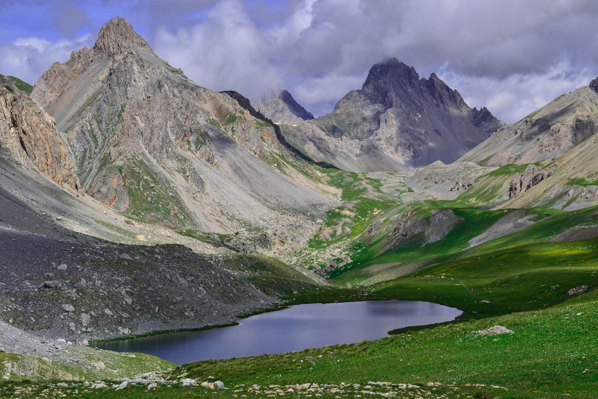
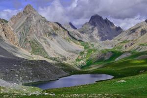
It’s impossible to sum up in a few words the grandeur of an itinerary that features the vast Gardetta high plain, surrounded by dolomitic spires, and the stunning Roburent lakes. It’s a thrilling outing through uniquely spectacular settings, far from mass tourism, in what is now a haven for hikers and bikers, whereas in the past it was a military zone of strategic importance.
As there can be snow around Rocca Brancia well into the summer months, the best time to enjoy this itinerary is from mid-July to early September. Those who are more physically fit could take on the first and second stages, or the second and third, in one day, but we recommend taking on the itinerary at a more leisurely pace so as to fully enjoy the great landscapes you will encounter.
It should be noted that the mountains are an environment subject to constant change and conditions that can vary depending on the weather, the season, climate change, and human influence. The authors and ATL del Cuneese (the Cuneo board of tourism) decline any responsibility for any injury or other harmful consequences deriving from use of the information provided. Each itinerary is to be followed at your own risk.
The Stages
the route
No result found
No result found


Discover
more

Start: Viviere (Acceglio)
Stage 1: Viviere–Rifugio Gardetta
- Ascent: approx. 650 m (2,100 ft, +200 m for Bric Cassin)
- Descent: approx. 100 m (325 ft)
- Total length: approx. 6.5 km (4 mi)
- Elevation at start: 1,813 m (5,950 ft)
- Highest elevation: 2,439 m (8,000 ft)
- Difficulty level: E (intermediate)
Follow the dirt road that heads gently towards Ciorliero meadow. At a fork marked by a tall pylon, turn onto the trail to the left. Climb among the larch trees along the upper edges of the enchanting Ciorliero meadow, a wide pastureland where there are ruins of old military buildings.
The easy trail begins to rise more steeply among the larch trees, which are beginning to thin. Looking back, you can see increasingly captivating views of Oronaye and the peaks that surround it. The trail runs above a pair of small pools of water. The meadows end suddenly as you enter an eroded area with characteristic gypsum outcroppings, where there are a number of bunkers of the Alpine Wall (Opera 180).
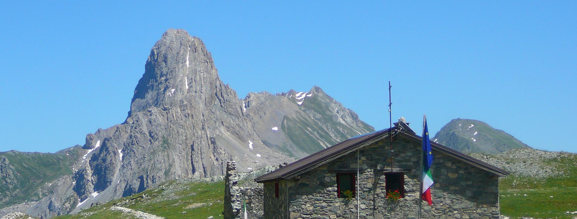
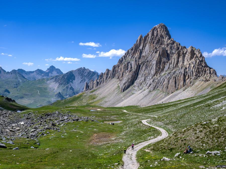
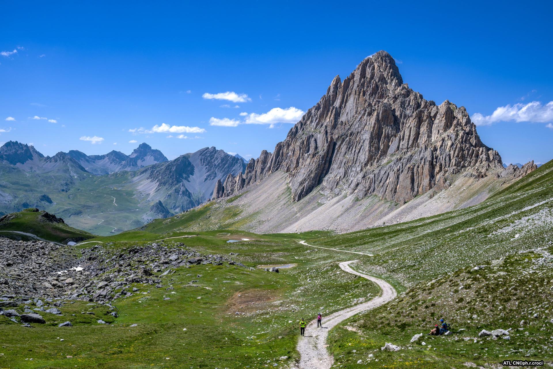
After a final traverse, you will arrive at the Gardetta Pass (2,439 m), where you can enjoy an exceptional view of the entire high plain. The panorama encompasses the dolomitic peaks that surround it and the impressive Rocca la Meja, the shape of which from this angle, is like the pointy fin of a shark.
Here, it’s worth taking a detour to the left along an easy trail that goes up to the panoramic Bric Cassin (for about 200 meters of additional elevation gain).
Follow the military road that winds gently down through the pastures (with possible shortcuts), where marmots reign supreme, until you reach Rifugio Gardetta (2,335 m).
Stage 2: Rifugio Gardetta–Bivacco Due Valli
- Ascent: approx. 510 m (1,675 ft)
- Descent: 220 m (720 ft)
- Total length: approx. 7.5 km (4.5 mi)
- Elevation at start: 2,335 m (7,660 ft)
- Highest elevation: 2,641 m (8,665 ft)
- Difficulty level: EE (expert)
From the alpine shelter, head west, not via the military road from before, but following an evident trail that heads up through the meadows and leads in the direction of Fonda Brancia.
When you reach a barracks, you can continue along the trail to the left (which is more direct but may have snow well into summer) or turn right to take the military road that cuts through the steep rocky outcroppings of Punta Eco and the steep Rocca Brancia.
The two routes meet up again just before the Rocca Brancia Pass (2,606 m). Ignore a trail to the right that disappears after a while and continue for a few dozen meters along the one that descends into the Stura valley. Turn right and continue around Rocca Brancia along a traverse that runs alongside characteristic, isolated rocky towers.
Further on, leave this trail for one that heads off to the right towards the evident passage through Colle Oserot (2,641 m), which is reached after a hairpin bend and a short ascent. The panorama here is severe, featuring dizzying reddish rocks, and extends out towards the upper Emanuel valley and the Croce Orientale (Eastern Cross) Pass in the distance.
Ignoring the old military road to the left, which is inaccessible because it has collapsed in several places, take the trail that bends to the right through unstable debris and descend to the base of the northwest ridge of Rocca Brancia.
Further down (look for markings on a boulder), turn left to follow a narrow trail along the other side of the valley in the direction of the military road that reappears steeply beneath a rocky wall. Then, traversing an insidiously loose rockfall, you will reach the road and flank a recess in the rock once used as an ammunition depot.
With a traverse to the northwest, continue the climb through long, grassy switchbacks to reach the Croce Orientale Pass (2,629 m). Continuing downhill, you will soon reach the small, spartan bivouac Due Valli (2,612 m). Due Valli means “Two Valleys”, a reference to the bivouac being located between the Maira and Stura valleys.
Stage 3: Due Valli–Viviere by way of Colle della Scaletta
- Ascent: approx. 220 m (720 ft, +200 m for Mount Scaletta)
- Descent: approx. 1,000 m (3,280 ft)
- Total length: approx. 9.5 km (6 mi)
- Elevation at start: 2,612 m (8,570 ft)
- Highest elevation: 2,639 m (8,658 ft)
- Difficulty level: E (intermediate) or EE (expert) with the climb to Mount Scaletta
Head towards the Peroni Pass (2,583 m) by traversing the steep slopes of Rocca Peroni. Much lower to the south, you will see the village of Bersezio in the Stura valley. Once you reach the pass, the panorama opens out onto the valley of the Roburent lakes, nestled in lovely prairies.
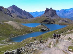
The trail continues downhill along a steep slope of yellow earth. After a few hundred meters, abandon the spectacular but challenging trail towards Mount Scaletta and descend to the left, skirting the middle Roburent lake (2,355 m) from above.
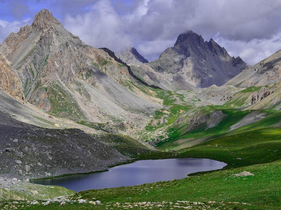
At the end of the lake, a short steep ramp takes you to the mouth of the enchanting upper Roburent lake (2,428 m), with its characteristic horseshoe shape, in a lush, green basin at the foot of the immense, rocky mass of Mount Oronaye.
Leaving the trail that flanks the lake, follow a fork to the right towards the Colle della Scaletta along the trail that leads away from the lakes. Go up the two hundred meters (650 ft) of steep climb to Colle della Scaletta (2,639 m).
From the pass, it’s worth taking a detour to the right along a steep, debris-strewn trail that goes through a long, manmade tunnel (a flashlight will be helpful) and leads to Mount Scaletta, an extraordinary panoramic point looking out over the Roburent lakes and Oronaye (for about 200 meters of additional elevation gain).
On the opposite side, the panorama changes radically. The trail descends in a broad semicircle into the Roccetta valley, passing huge, erratic boulders that give the landscape an almost lunar appearance.
Once you reach the Escalon Pass (2,415 m), which isn’t particularly evident, descend through a number of steep zig-zags into the Costa Denti valley. The rocky debris gradually gives way to pastures, and the first larch trees begin to appear.
Ignoring two forks to the right that lead, respectively, to the shelter of the Escalon and to the upper Emanuel valley, the trail bends to the left, flanking a panoramic knoll on which there is an altar overlooking the Ciorliero meadow (1,910 m). From here, you can enjoy excellent views of the start of the Unerzio valley.
Once you have nearly reached the base of the great plateau, take a lovely trail to the left through the larch trees that leads back to the dirt road followed during the first stage.
All you have to do now is go back the last seven hundred meters to your car to complete this splendid itinerary.