REVELLO, VALLI PO BRONDA E INFERNOTTO
THE CHAPELS OF REVELLO
approx. 11 km (7 mi)
Revello is a town with a beautiful historic center and mild climate at the sunny base of Mount Bracco at an elevation of just 350 meters (1,150 feet). This makes it the perfect spot for a stroll in winter and in the milder seasons. The Chapels of Revello itinerary is also known as “the Garden of the Marquises”. “Garden” may not be the best way to describe a hike on the steep slopes of Mombracco, but as for “marquises”, one need only stroll through the streets of Revello to discover a town steeped in history, one that was of great importance to the Marquisate of Saluzzo.
The Stages
the route
No result found
No result found

Discover
more
Start: Piazza della Vittoria, Revello
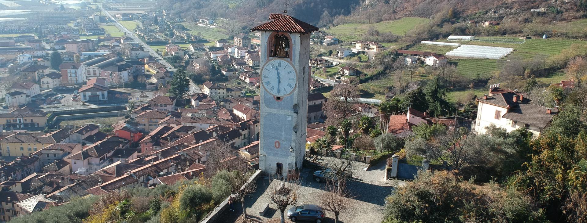
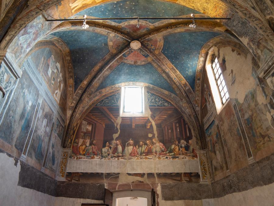
From Piazza della Vittoria, from which the bell tower is clearly visible, head towards the main street of the town. Once in Piazza Denina turn left, pass in front of the town hall and the cylindrical tower which houses the Marchional chapel with its invaluable frescoes.
Immediately after, turn right and head towards the fifteenth-century canopy of the covered market. Go around the market to the right and onto the cobblestone road that rises westwards, passing almost immediately under an arcade.
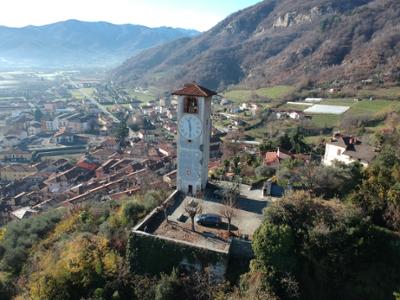
After about two hundred meters (700 feet), turn right onto a staircase that shortens a hairpin bend. Rejoin the road and follow it to the right, arriving shortly at the Campanile delle Ore bell tower, from where you can enjoy the exceptional panorama. At one corner of the tower, the breaches caused by a German shelling in the summer of 1944 are still evident.
Continue along the cobblestone road that rises from the square and through the ancient walls of the town. When you reach a vineyard, take a short detour to the right up a staircase that then brings you to a trail. Head right, first flat and then down slightly to the chapel of San Biagio (fountain), which is dedicated to the town’s patron saint.
Continuing on, you can visit Fort Bramafam, part of this stronghold’s complex system of defense. After your visit, head back to the steps, but continue straight on without descending them. You will soon be back on the cobblestone road from before, which has now turned into a dirt road.
In about two hundred meters (700 feet), you will reach Colle della Croce (482 m, of little historical interest), where there is a paved road. Turn left onto the road, which almost immediately turns into a dirt road (with a few brief cobbled sections). As you climb, you will be able to enjoy some beautiful views of Revello.
In a few hundred meters, leave the road and turn right on a mule track that passes beneath the crag of Santa Lucia, a popular local climbing wall. After passing through the woods, change direction to climb a staircase supported by wooden logs, which leads to the seventeenth-century chapel of Santa Sofia, where you will find a number of picnic tables. On a clear day, the views from here are breathtaking.
Continue from behind the chapel along the access road that joins up with the road from before. Turn right, pass a hairpin bend and then cross a sandy piece of road. After a steeper stretch, you will reach a rocky plateau and the panoramic bell tower of San Leonardo, built in 1930.
The chapel to which the bell tower belongs stands alone about a hundred meters (roughly a hundred yards) away. To visit the chapel, take a trail that breaks off from the dirt road and leads to a curious building beneath a rocky overhang. The oldest part of the chapel dates back to the 1200s, but it has been expanded over the centuries.
Once back on the dirt road, continue up alongside the remains of an old structure hidden in the vegetation above you. Ahead of you, you will also see the ancient alpine huts of the village of San Michele. Before you reach these huts, turn right along a short, steeper stretch of road that leads to a ridge at a crossroads.
Turn right and follow the ridge, passing almost immediately a steep stretch with a potentially slippery surface. The trail continues along this lengthy ridge. Although the views are almost completely obstructed by vegetation, occasional glimpses out over the plain and the peaks of the Varaita and Po valleys can be enjoyed.
After several ups and downs, the woods thin out and allow you to see your destination, the chapel of San Bernardo and the cross of Riofreddo above it. From here, there are two ways to reach your destination: a trail that heads up the steepest route or a less steep but somewhat eroded trail that bends first to the left and then to the right.
The chapel of San Bernardo (768 m), located on the border between the municipalities of Revello, Rifreddo and Evie, is a very popular spot for a family outing or as a stop on a hike or bike ride. The panorama that you can enjoy from this pedestal is truly stunning and stretches out to ridge that divides the lower Po valley from the Gilba valley.
The return trip is simply the outward route in reverse.