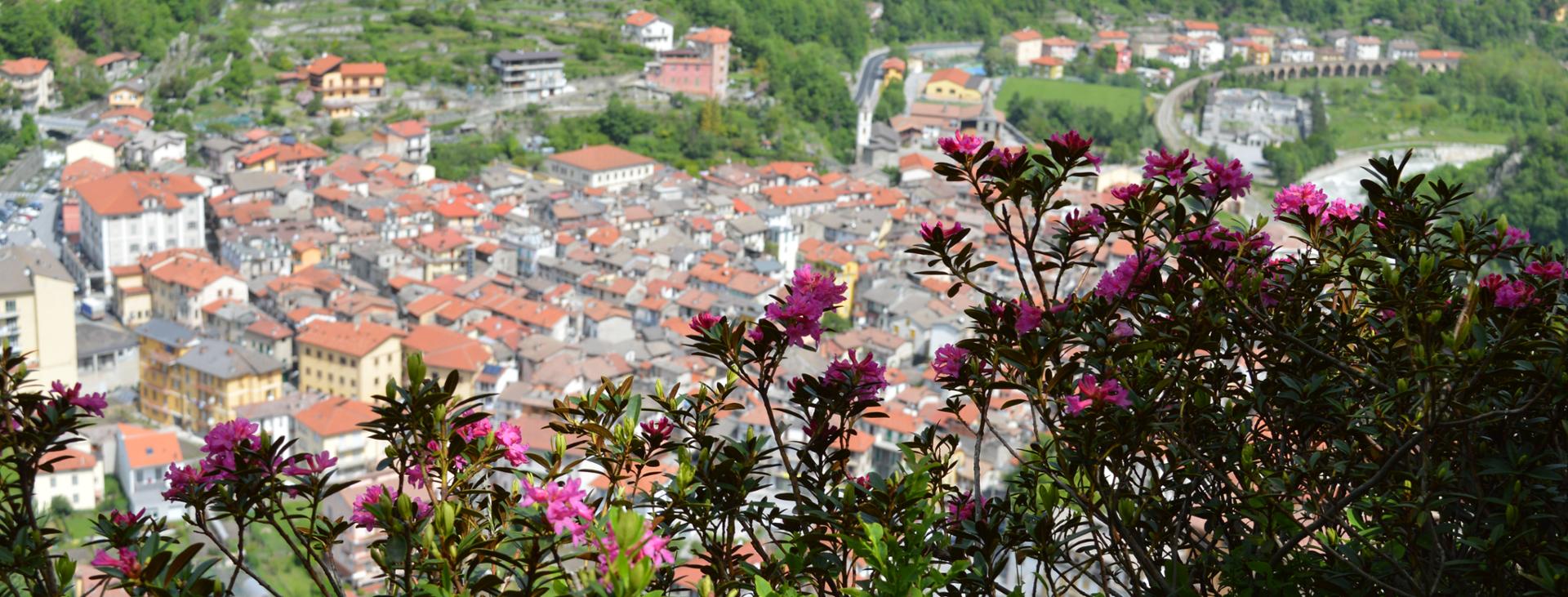
ORMEA, VALLE TANARO
THE BALCONY OF ORMEA
32 km
An incredible journey in the Valle Tanaro: the Ormea balcony is a naturalistic and ethnographic itinerary commissioned and restored by the CAI section of Ormea. It runs along the southern slope of the Tanaro Valley from Eca to Viozene, at an altitude ranging from 900 to 1500 metres. In this way, villages and hamlets are linked together along a 32 km route, which can be divided into stages for the less trained, or tackled all in one breath by the fittest cyclists. Dirt tracks on which to pedal, sweat and share unique sensations with biker friends. And then reach the top, where you can enjoy a breathtaking view.
Please note that itineraries may include roads where motor vehicles are allowed. Authors and trail testers are not responsible for the information contained.
Following the flood of last October, some sections are not yet practicable and/or accessible. Contact the Tanaro Valley tourism office for more information.
The route may vary due to scheduled maintenance.
The Stages
the route
No result found
No result found
Discover
more
The route is about 32 km long from start to finish, with an elevation gain of over 1500 metres. It is an itinerary that we recommend you tackle with a front or full MTB or e-bike as the terrain it features is mostly unpaved and bumpy.
The route starts from Ormea, from Piazza della Libertà, and goes up the road towards the Armella Valley along the Armella river for a stretch. Skip the detour to the right for Villaro and pass through the hamlets of Pronai Inferiore (865 metres) and Pronai Superiore (910 metres). At an altitude of 1020 meters, having travelled 4.6 km, leave the paved road and go down to the left along a grassy path. After crossing a wooden bridge, turn left into the meadow where you’ll encounter some dry stone walls. Climb up alongside these on your bike, overcoming a small elevation gain, until you come to a sheep track with a decent surface that goes back up the slope towards the south, leading to the Colla Chionea. The Colla hosts the beginning of an uphill trail leading to the Valcaira Refuge and a path on the hillside that goes back up the Armella Valley and leads to the Pizzo d'Ormea lakes. The only feasible cycle path is the paved one on the right that goes down to the Case Chionea.
Once you’ve reached the paved road, turn left downhill and from the centre of the inhabited area turn from the church towards the west. The road soon becomes a dirt track. About a hundred metres on, at the first crossroads, turn onto the high road, taking a welcoming sheep track in the woods. By following the white and red notches, you will arrive at the Porcirette hamlet, in the centre of which a house divides the road in two. Take the low road and, past the last house, a flat grassy trail will accompany you for a while. In the beech wood, a single-track takes you to the end of the village. There, after crossing the Rio Chiapino, a steep but rideable climb awaits you stretching as far as the cemetery of the Chioraira area. Of all the villages encountered along the Balcony of Ormea, this one is particularly striking for its ancient and large stone houses that enclose the church with its towering bell tower.
At the end of the town, having ridden past the Rio Rava Grossa, take the wide dirt road that climbs towards the hamlet of Aimoni. The road, which has a good surface, winds through the larch trees, climbing steeply and with a constant gradient until it reaches the La Colma hollow. On your way down from the chapel, swing onto the first street. The route develops on a natural balcony that overlooks the top of the Tanaro Valley and below you can see the remains of the old road that went up from Quarzina, now no longer used.
After passing the Biranco area, one of the most striking locations of the entire route, downhill fans can finally come into their own, cycling on a track in steep descent through beech and larch trees that offer a multitude of magical colours in autumn. At times fast and at times technical, the sheep track reaches an altitude of 1210 meters, where it is also joined by a cart track. Once in Carpo, go down to the right at Ponte di Nava and then return to Ormea by following the SS28 for 8 km.
Download Cycling and Cycling Tourism Itineraries in the Province of Cuneo