
ACCEGLIO, CASTELMAGNO, VALLE GRANA, VALLE MAIRA
FORTIFICATIONS PATH
from Acceglio to Castelmagno (55,86 km)
55,86 km
The Sentiero delle Fortificazioni is an itinerary of approximately 60 km that develops among the upper Maira and Grana Valleys allowing you to admire numerous fortifications built for defence purposes.
Please note that itineraries may include roads where motor vehicles are allowed. Authors and trail testers are not responsible for the information contained.
The Stages
the route
No result found
No result found
Discover
more
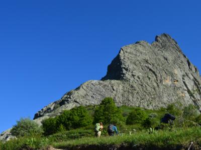
Going along it means taking a leap into the past, stopping to admire the remains of barracks, casemates, bunkers and ferratas built by soldiers on these mountains. The most attentive observer can only ask himself questions about the enormous difficulty of building these artifacts, given the precariousness of the means and techniques, the rather hostile environment, especially in the winter months, and not to mention the distance of connecting roads.
The roads that once connected the hand-built defensive works along the stony and rocky slopes have now partly collapsed, but the stretches of dry-stone walls and rough paving that still survive bear witness to the great skill of those who worked on the construction of what is now known as the "Vallo Alpino", the most ambitious fortified system to defend the borders of Italy.
The dominant aspect remains, however, in the majesty of the natural environment that you are going to cross; the place that best sums up these characteristics is the Altopiano della Gardetta, a place on the border between Italy and France, but also between the Maira, Grana and Stura valleys; still today a walk in this place represents a journey back in time: from the remains of the ancient 18th-century "trune", to the various barracks of the Bandia and Lake Meja, to the bunkers and casemates that look out over the pastures and rocky slopes with their white, round roofs built in anticipation of the Second World War.
Difficulty: difficult hiking trail
The detailed route is available on VISITPIEMONTE.COM