CARAGLIO, PRADLEVES, VALLE GRANA, VALLE MAIRA, VALLE STURA, VIGNOLO
CURNIS AUTA
from Caraglio to Vignolo (103,00 km)
103 km
The Curnis Auta is a long ring-route around Valle Grana, passing mostly on the watershed and linking the valley with Val Maira to the north and Valle Stura to the south.
Please note that itineraries may include roads where motor vehicles are allowed. Authors and trail testers are not responsible for the information contained.
The Stages
the route
No result found
No result found
Discover
more
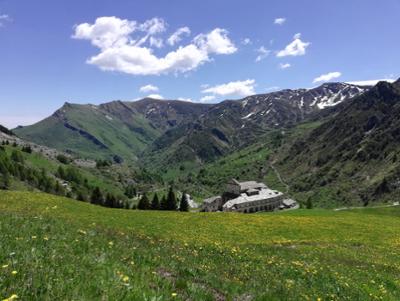
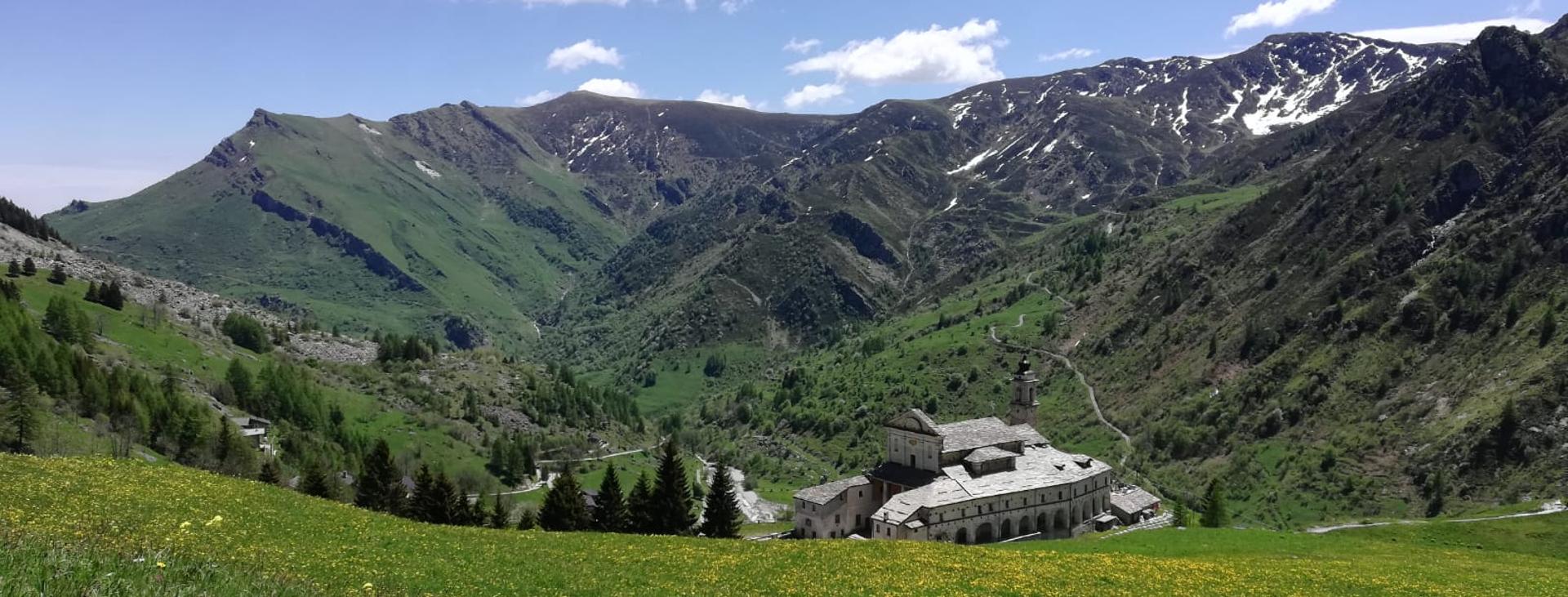
The route is characterised by a continuous variation of landscapes, which makes it very interesting both from a panoramic and naturalistic point of view. It progresses often along the crest, guaranteeing continuous views of the Alps both to the south, with the Argentera and Gelas groups standing out, and to the north, where the pyramid of Monviso is a true north star, taking nothing away from Cervino and Monte Rosa in the background on the clearest days.
The departure from the Filatoio di Caraglio (silk factory), a symbol of the historical-artistic wealth of the territory, is on the plain, while the highest point of the route is at over 2500 metres, with a wonderful view across the mountains. Along the route you can admire a rich fauna, and an extraordinary botanical wealth, with extremely rare species of orchids and flowers, such as the narbonense linum, which bloom only in this area of the Alps. In the upper part of the valley the eye will be captivated by the imposing silhouette of the Sanctuary of San Magno, that has taken up the legacy of a pre-Christian prayer site since the 15th century.
The return, on the other side of the valley, crosses the entire area of Monte Bram, Paraloup, Chiot Rosa, where personalities of the calibre of Galimberti, Dante Livio Bianco, Nuto Revelli etc. contributed to writing the history of Italy in the passage from the war to the republic.
The itinerary has no particular technical difficulty, and is suitable for all hikers, provided they are fit. There are welcoming accommodation facilities that are ready to refresh and offer you a simple and authentic welcome in the Alpine valleys.
Difficulty: hiking trail
The detailed route is available on VISITPIEMONTE.COM